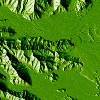
Digital elevation models (DEMs) are arrays of regularly spaced elevation values referenced horizontally to a geographic coordinate system. It is a 3D computer graphics representation of elevation data to represent terrain from ground positions sampled at regularly spaced horizontal intervals.
A geographic information system is helping users make smarter decisions by revealing deeper insights into data, such as patterns, relationships, and situations. GIS is a framework for gathering, managing, and analyzing data rooted in the science of geography. It analyzes spatial location and organizes layers of information into
Machine learning is an application of artificial intelligence (AI) that provides systems the ability to automatically learn and improve from experience without being explicitly programmed. Machine learning focuses on the development of computer programs that can access data and use it learn for themselves.
Interferometric Synthetic Aperture Radar (InSAR) is an effective way to measure and monitor displacements in land surface retrieving surface movements and velocities with unprecedented resolution and precision. Its huge advantage is that no field survey markers are necessary as well as possibility of access to historic radar data.
Photogrammetric processing technologies can be used to create terrain models, obtain 3D-vector data, and create orthophotos. Their use has already become commonplace for engineering, environmental and infrastructure planning, as well as state mapping.
The most recently developed method of surveying shallow waters is the satellite-derived bathymetry. Opposite of other survey methods, it does not require mobilisation of personnel or equipment providing rapid access to bathymetric data saving costs at the same time. Satellite bathymetry makes operations in shallow water more effective and reduces project risks.
This remote sensing method combined with other data recorded by the airborne system generates precise, three-dimensional information about the shape of the Earth and its surface characteristics. Topographic lidar is used to map the land, while bathymetric lidar is measuring seafloor and riverbed elevations. Lidar serves to produce more accurate shoreline maps and digital elevation models.
Hyperspectral imagery provides the potential for more accurate and detailed information extraction than possible with any other type of remotely sensed data. Hyperspectral images are spectrally overdetermined, which means that they provide ample spectral information to identify and distinguish spectrally unique materials.
We are improving current services and we are working on creating new ones.